

Tropical Storm Arthur
May 10, 2020
Topics: Tropics, Forecast Discussion
Well, the water temp has just broken 70, and we have our first tropical storm of the season approaching the coast of NC. Official NHC forecasts have it coming close to, or over Cape Hatteras as it travels NE. These are the conditions where a nearshore wave model should give this site the advantage since conditions are highly dictated by local winds. Here is an overview of the model as it stands at 9pm. I’ll try to do a post event analysis to see how things performed.
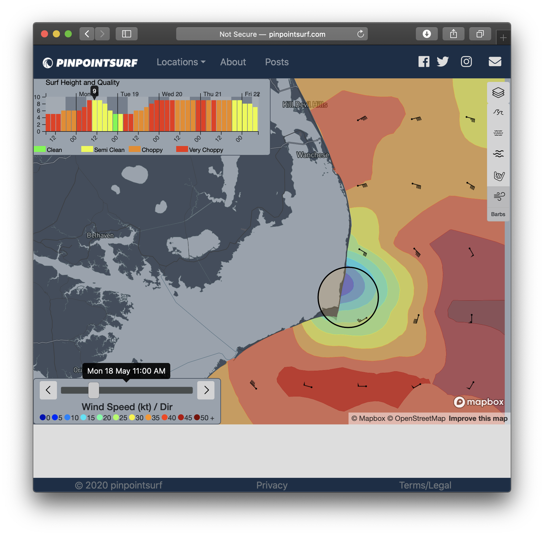
Outer Banks
Looks like it is going to be a windy mess with big, disorganized surf and victory at sea conditions. Even once the wind switches offshore, it will be 35mph or higher.
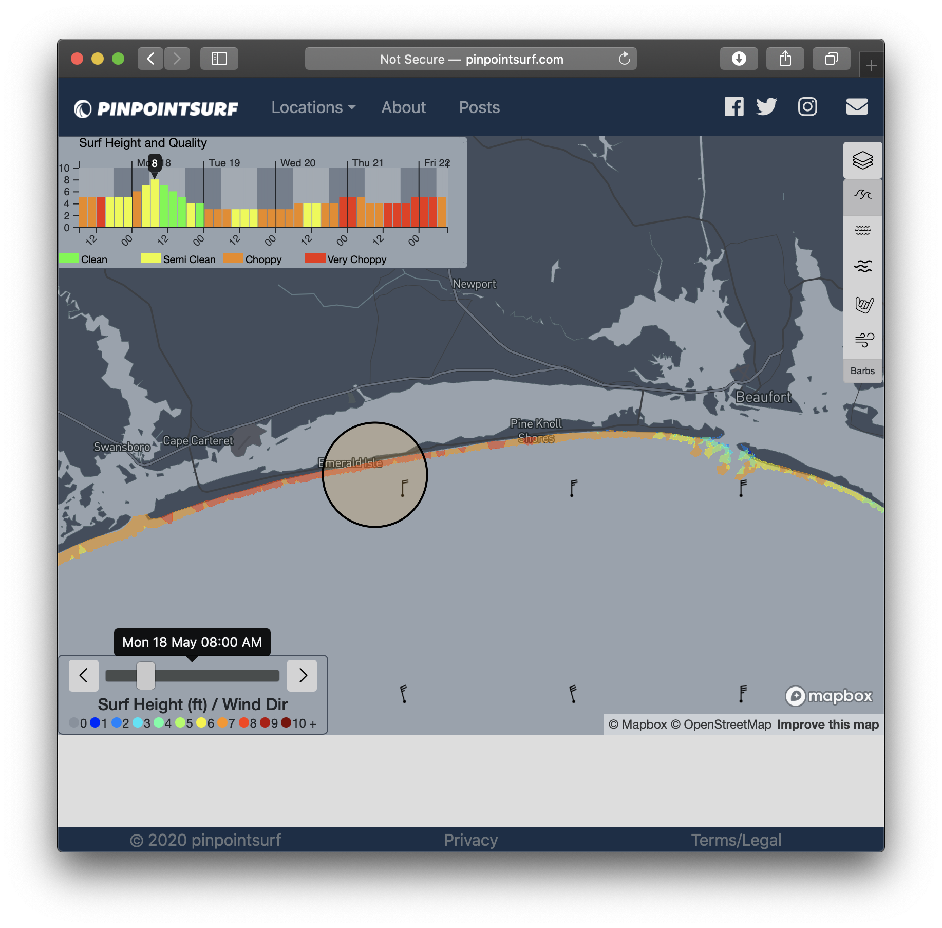
Bogue Banks
Better conditions moving south with some relief from the wind. While still stiff offshore early on, wind should diminish throughout the morning as it turns NW. Spots West of Pine Knoll Shores should pick up a little more size due to the swell direction.
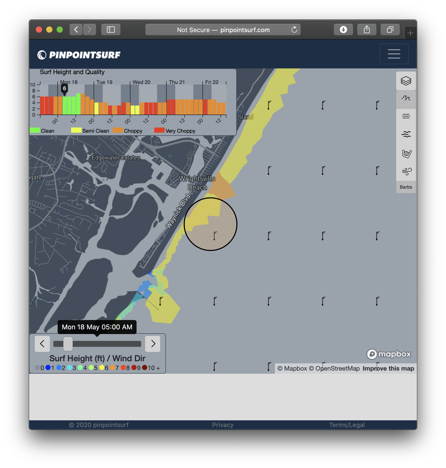
Southern NC
Topsail should be the first spot to clean up, followed by WB and CB. Quarter-offshore at first, but moving fully offshore by mid morning.
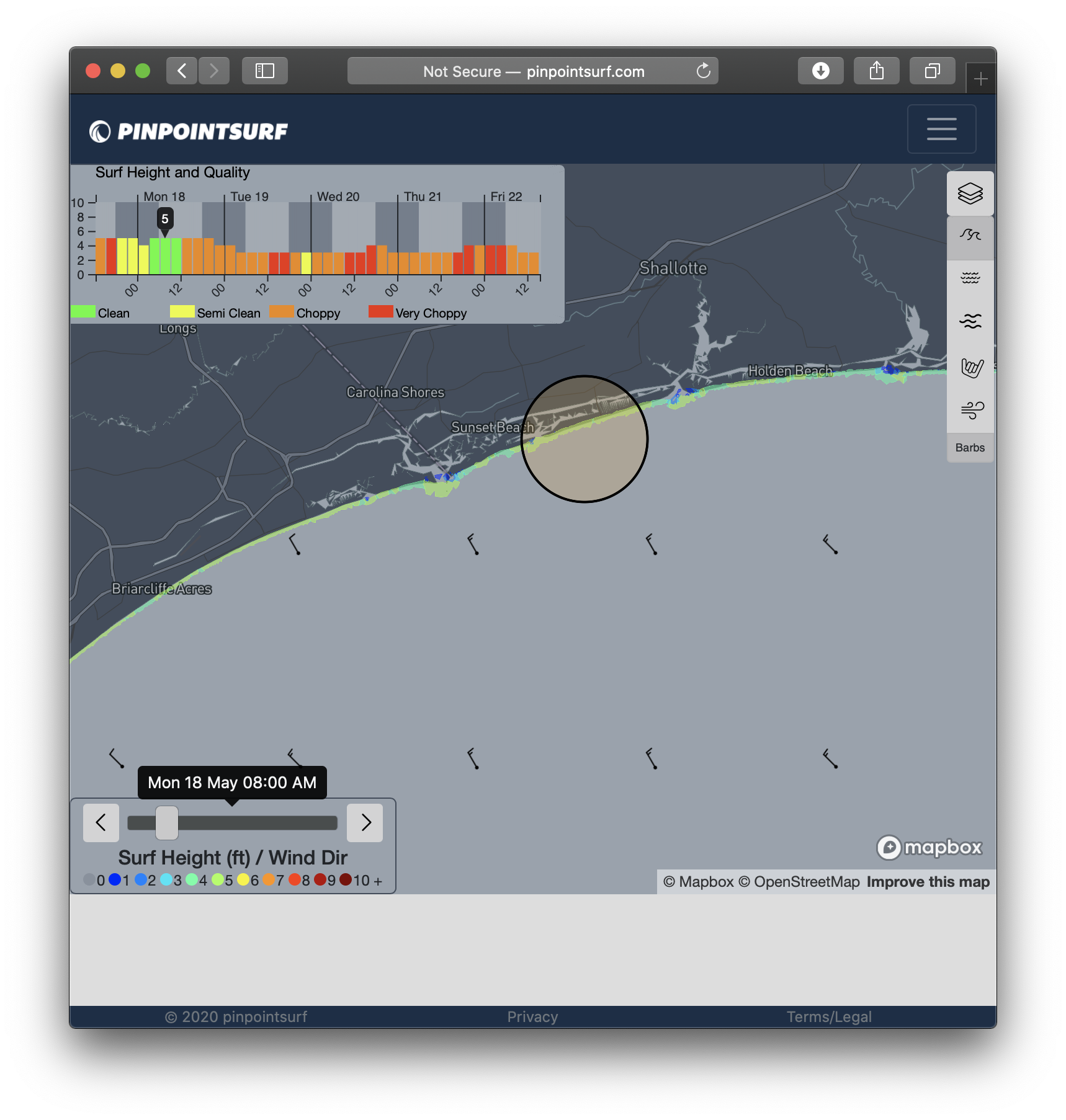
Brunswick down SC coast
Looks like 4-5 surf with clean offshore winds in the morning. Areas East of Holden will be smaller due to Frying Pan Shoals blocking some of the energy.
Happy surfing.
-Eric