Bathymetry Improvements
October 26, 2020
Topics: Wave Modeling
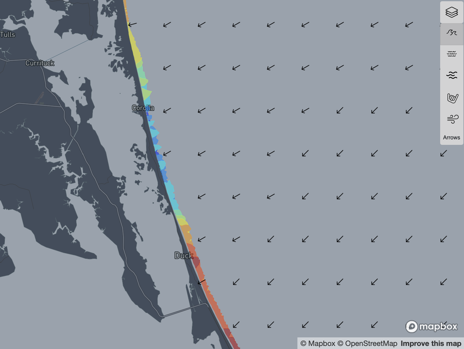
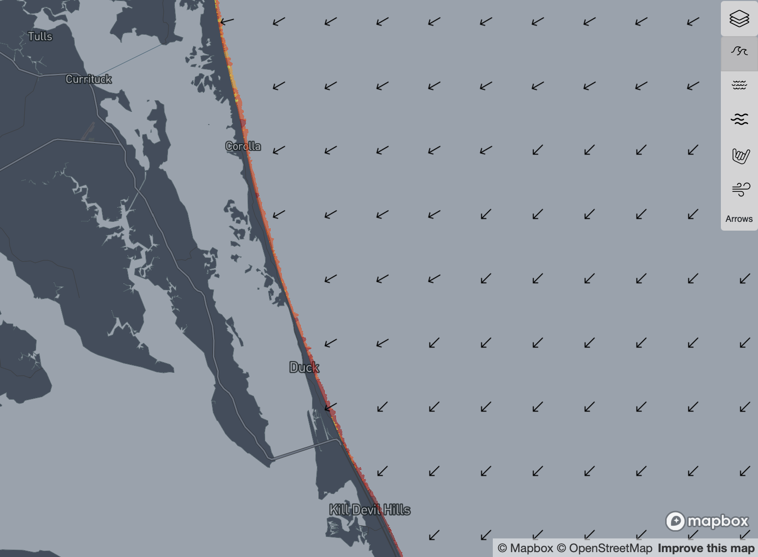
The bathymetry that I was previously using in the model, was very old and out of date. As I’ve posted before, I knew there were some problem areas such as the jetties at Masonboro, Wimble Shoals (Rodanthe), and the area between Duck and Corolla. While the deeper bottom features past the surf zone shouldn’t change that much, there was obviously some bad data that went into this depth model that resulted in reduced wave heights in these areas.
Shoaling is the process by which waves interact with the bottom. It can cause waves to both change direction and break, but also reduces their energy as they encounter bottom friction. If the bottom slope is not representative of the actual shoreline, the model can either reduce energy too much or not enough depending on the direction of error. In the case of the areas around Rodanthe and Corolla, the slope was much too gradual resulting in the model excessively reducing energy of incoming swells.
The newer bathymetry is based on my own custom blend of Lidar data, and the older bathymetric models for features that are too deep to measure from an aerial survey. The result is the best I can do, without pulling a sonar scanner up and down the coast (which actually sounds like fun, but I have a day job).
Below is a side by side comparison with our most recent Hurricane Epsilon swell, showing the wave height differences between two bathymetry inputs.