

Hurricane Larry
September 7, 2021
Topics: Tropics, Forecast Discussion
Larry is large...
Larry is a good example of a well behaved hurricane. It started just off the coast of Africa, and has tracked just north of due west for most of its journey. Rather than spin up quickly and burn out, it has made gradual increases in intensity that resulted in multiple eyewall replacement cycles. These cycles typically bring down the peak winds but enlarge the overall wind field. For example, as of tonight's hurricane recon mission, the hurricane force northerly wind field extends a full two degrees north of it's center. That's ~140 miles worth of 74mph+ wind aiming right at our coast. To top it off, it looks like it may miss land all together which is always appreciated.
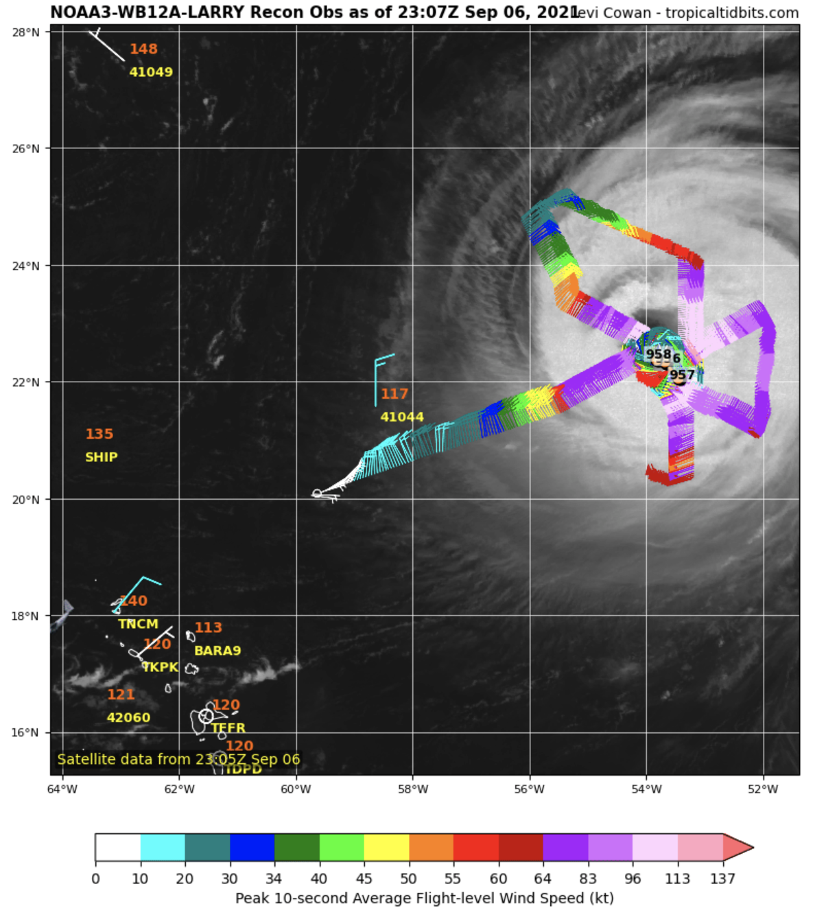
NOAA Recon Overlay Courtesey of tropicaltidbids.com
The NOAA GFS model should be pretty set in it's treatment of Larry as far as its windfield over the next few days. The hurricane's appearance hasn't changed much in several days and is considered an "annular" hurricane. This essentially means it is able to maintain it's own favorable environment by fending off dry air and shear. Due to this, I expect the size and timing of the pinpointsurf model to line up well with actual conditions.
Larry can surf:
Thursday:
Thursday looks like most of the local winds will be favorable for east facing beaches with a westerly wind. Size should be picking up early in the morning and becoming more consistent much of the day. Check the pinpointsurf model for your local spot, as even some of the more exposed spots near Folley could be in the chest high range. The Brunswick County beaches will be swell blocked by Frying Pan Shoals for much of this swell. North of Cape Fear, things are lining up to be in the head head-plus range. North of Lookout and Cape Hatteras, expect large looming sets with lots of water moving.
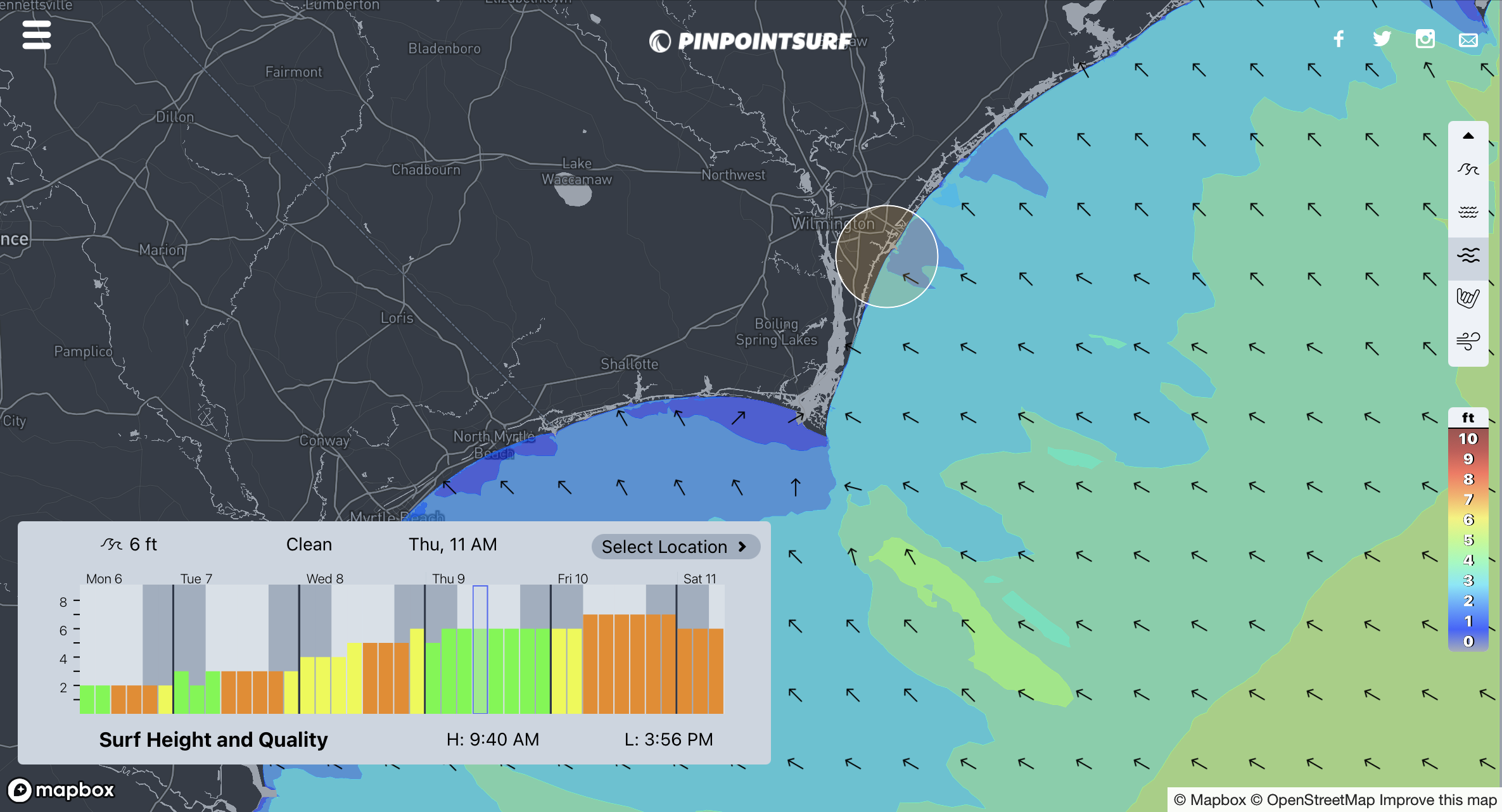
Friday:
Friday morning the swell peaks, but things get more difficult with a stiff NE wind. Some of the south facing beaches will offer shelter, but less size. However, that may not be too much of a sacrifice as many of the east facing beaches will be rather large at 8-10'+. Pan round the pointpointsurf map to see if there is something that fits your liking. Afterall, that is the primary advantage of this site.
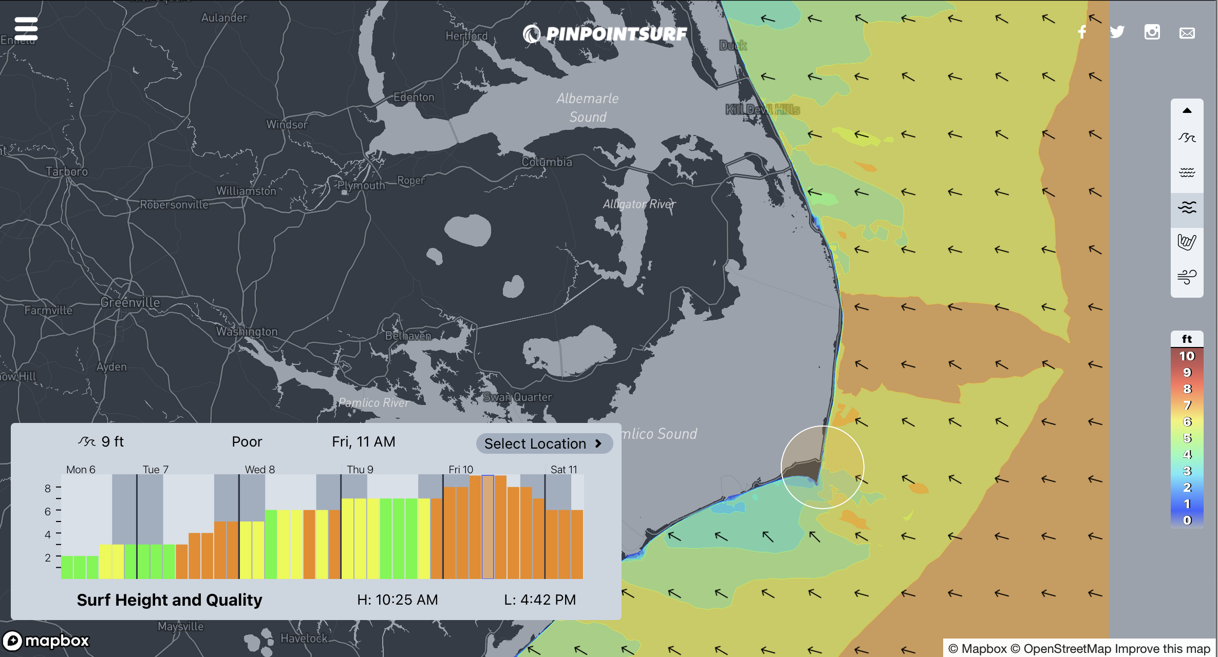
Some of the exposed spots could get pretty large, pretty quick during Thursday and into Friday. Rip currents and localized overwash should be expected. Refer to NOAA warnings for more specific information.
Due to the size of the storm and it's long trek over open water, I expect sets will be pretty consistent with some arm burning workouts at the larger spots. Know your limits and look out for others, espeically swimmers who frequently underestimate conditions like these.
-Eric