

Problem Areas
September 19, 2019
Topics: Wave Modeling, Bathymetry
Hurricane Humberto swell is here, but will fade this weekend.
Hopefully you’ve found a spot to hide from the NE wind. I’ve been using this as an opportunity to do some tuning and verification on surf heights and thought I’d share a couple areas that have been giving the model trouble.
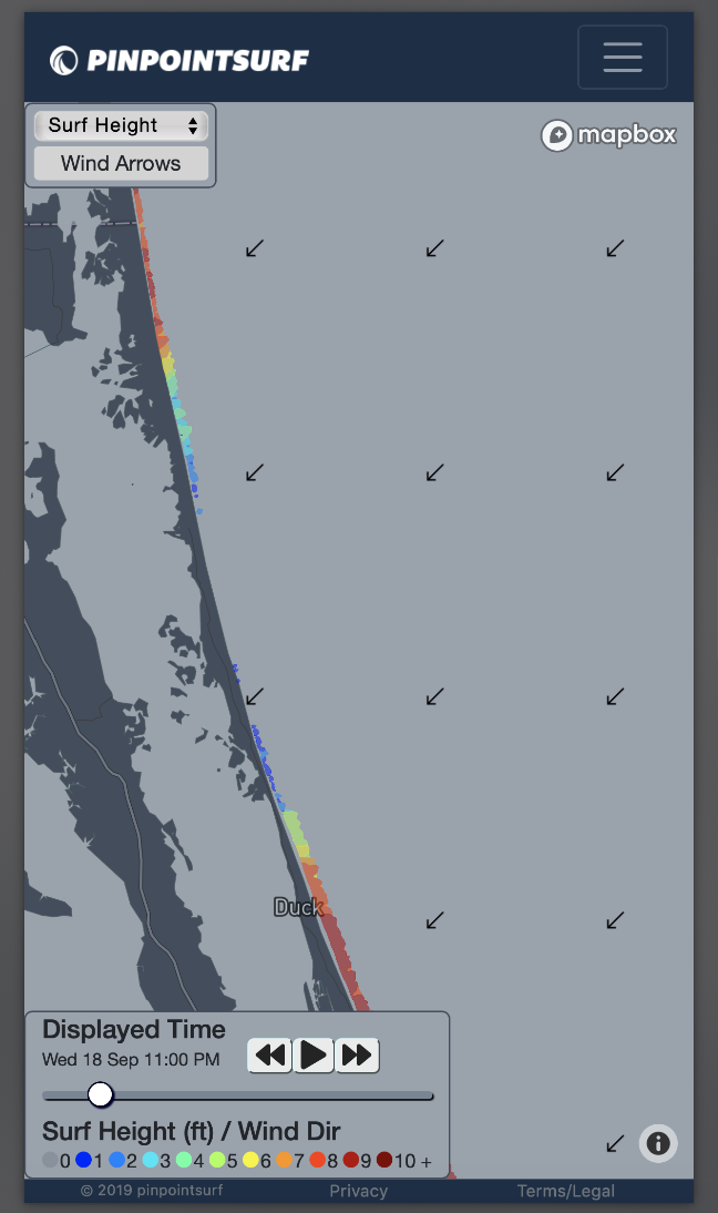
Corolla, NC
The seafloor feature is named False Cape Shoals, and is probably the worst of the problem areas. The Bathymetry source I’m using has some real issues in this location. The seafloor slope away from the beach appears to have been interpolated poorly and results in too much friction between it and the incoming wave energy. I dug through the sources and bathymetric surveys, and the only public survey available was from the late 1800’s (yes, you read that right). You can clearly see it on the image below, where there is an area of zero surf surrounded by appropriately sized 8’-10’ breakers North and South of it.
Rodanthe, NC to Salvo, NC
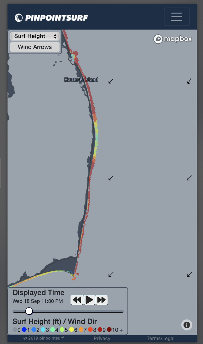
This one only tends to show up when it gets big. Wimble Shoals is the name of the undersea feature in this area, and consists of a few large sandbars that run diagonally SW-to-NE from Salvo. This is one of those areas that shifts constantly, and my guess is the bathymetry data was sort of guessed in this area. The effect on the surf calculation is the same as Corolla, but to a lesser extent. Unfortunately this affects S-Turns to some degree, as it’s at the northern extent of this problem area.
How to Fix It?
The obvious way would be to get better bathymetry data. This is not trivial for a few reasons, but it is my long term goal for these areas. The other way is to tune around it. I’m experimenting with different energy dissipation parameters to see if I can get some more realistic results without breaking the calculations in other areas. As soon as I feel confident in a workaround, I’ll roll it out and update this page.
-Eric